Stop Guessing. Start Exploring.

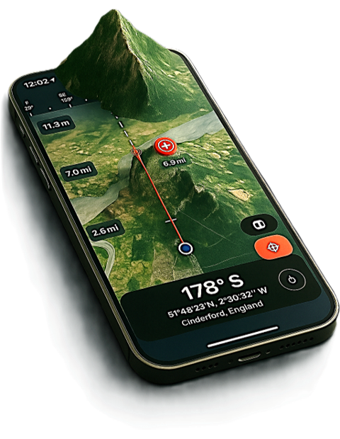
Transform your iPhone into a precision GPS compass with real-time satellite mapping. Perfect for hiking, exploring, and outdoor adventures.

View in App Store
Compass Explorer GPS Navigation App

Every Detail, Perfected

Compass Explorer Interface

Smooth Bearing Indicator

See your heading update in real time with ultra-smooth animation. Instantly know your direction with precision.

Distance Scaling with Zoom

Dynamic scale bar adapts as you zoom, showing distances from feet to miles for perfect trip planning.

Target Lock Navigation

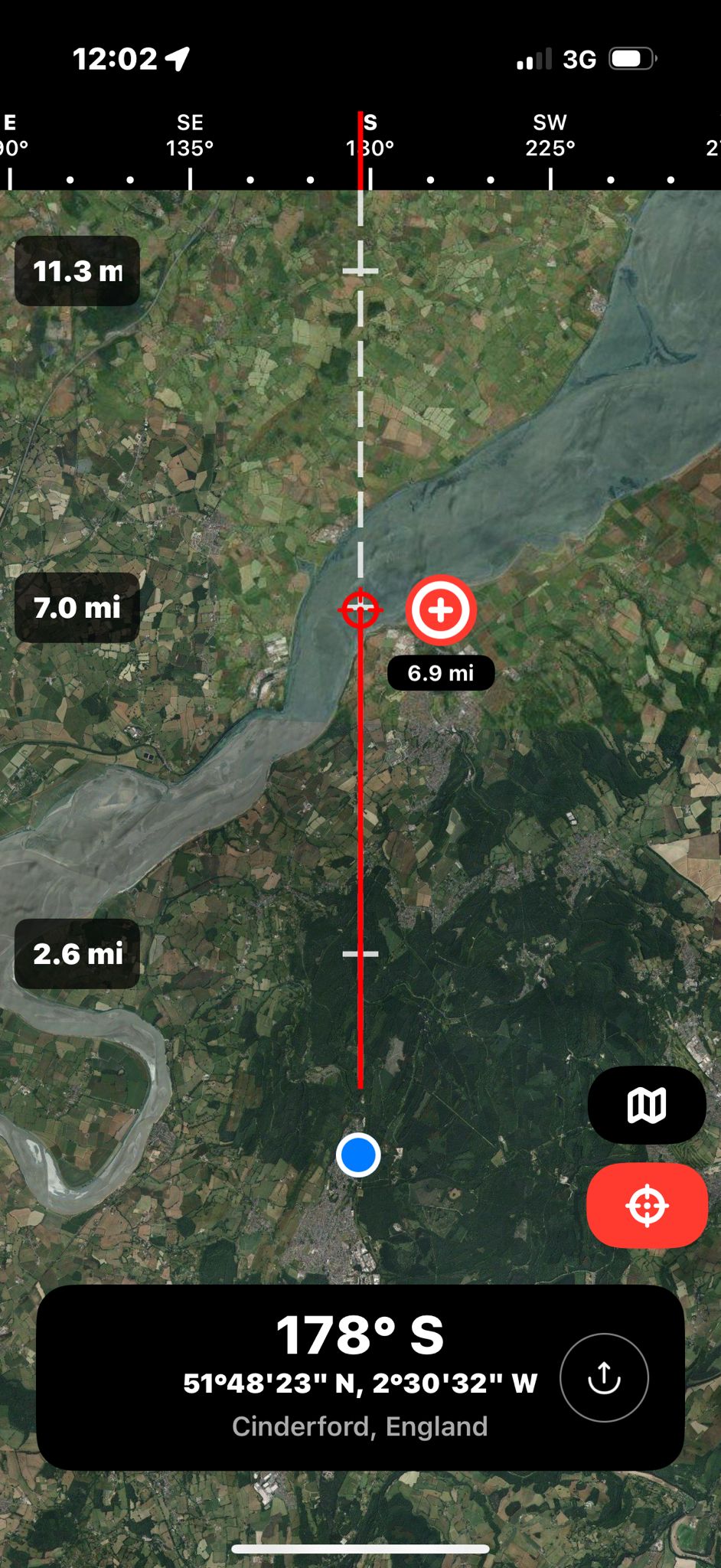
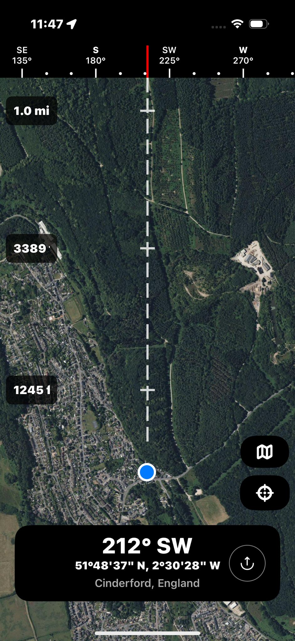
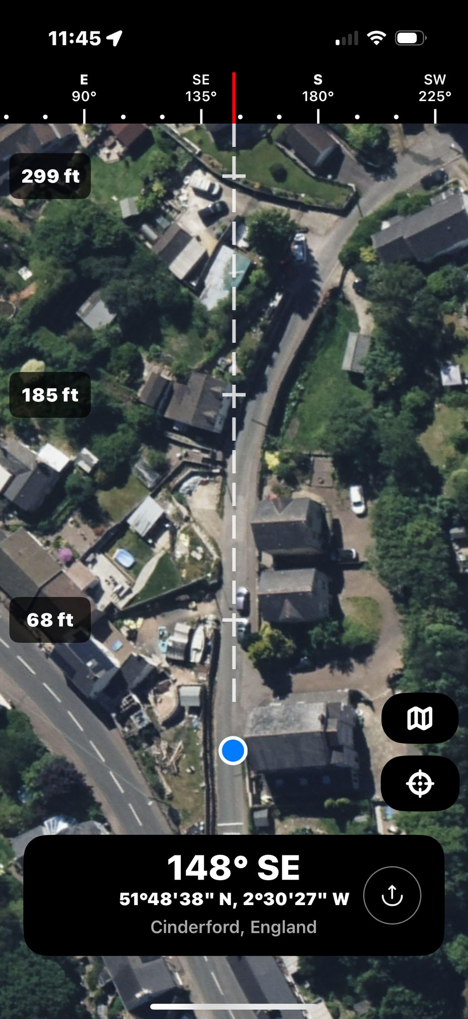
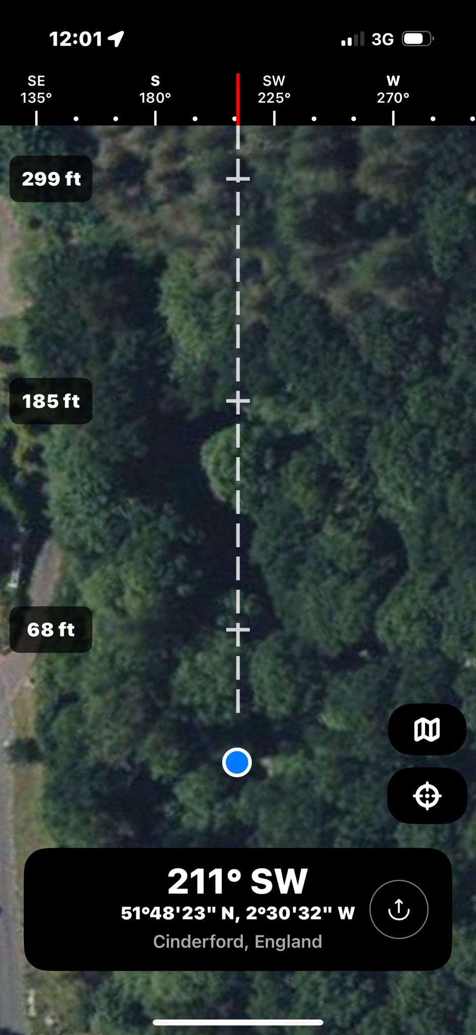
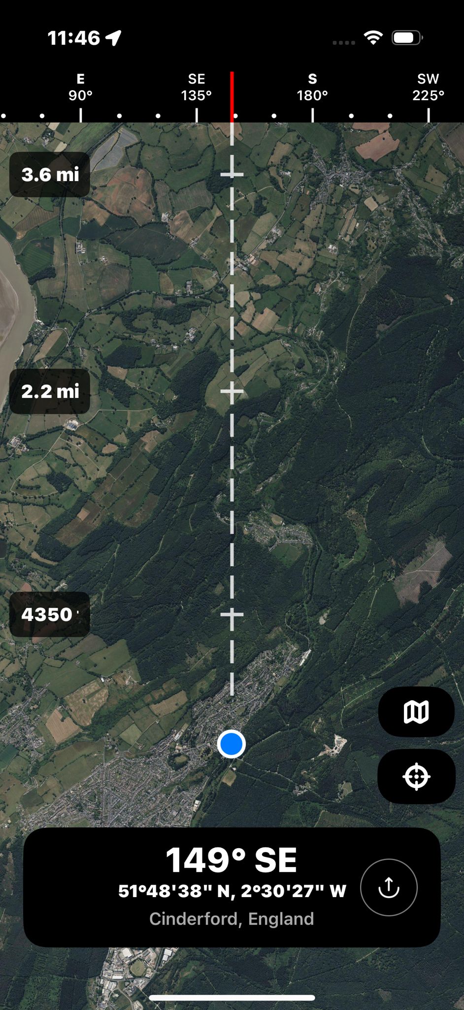
Drop a pin to lock your destination. Get real-time bearing and distance to your target, even off-trail.

Pinpoint Location Accuracy

GPS coordinates displayed to the decimal. Trust your position for surveying, hiking, or geocaching.

Easy Location Sharing

Share your exact spot with a tap. Send coordinates or map links to friends for meetups or safety.

Precision Navigation Features

Destination lock feature showing pinned target with real-time distance and bearing measurements

Destination Lock & Distance

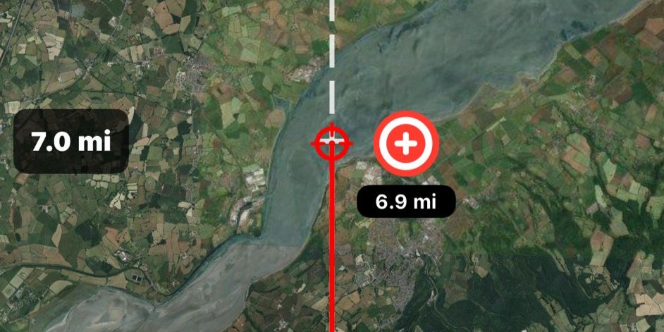
Drop a pin anywhere on the map to lock your destination. Get real-time straight-line distance and bearing measurements to guide you directly to your target.

Our destination lock feature is perfect for off-trail hiking, geocaching, or finding your way back to camp. Simply tap and hold any point on the map to set your target. The app displays continuous distance updates in meters or miles, plus your exact bearing.

The vivid directional line overlays on your map, making navigation intuitive even in challenging terrain. Combined with haptic feedback when you're on course, you'll never second-guess your direction again.

Dynamic distance scaling showing different zoom levels with precise measurements

Dynamic Distance Scaling

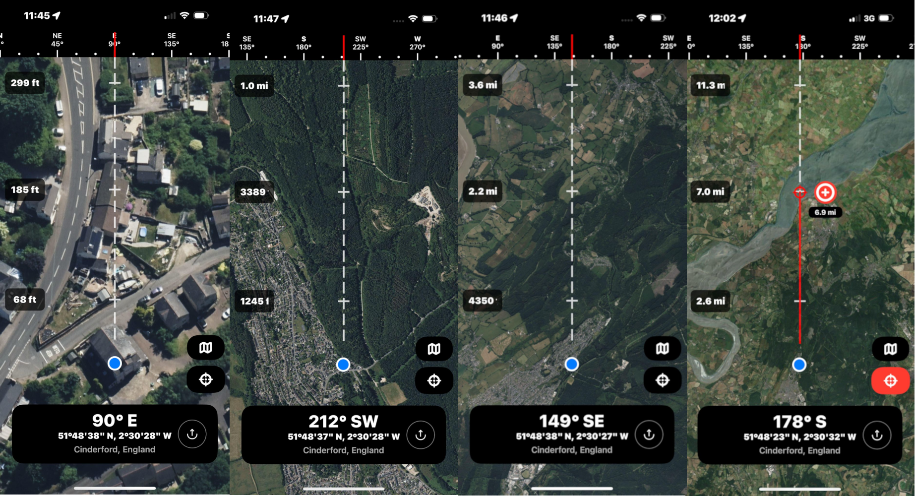
Intelligent distance measurement that automatically recalibrates as you zoom. See distances from feet to miles with pinpoint accuracy at any map scale.

Unlike traditional compass apps, our sliding distance scale adapts to your zoom level in real-time. Zoom in for precision measurements down to 50 feet for close navigation, or zoom out to see distances in tens of miles for trip planning.

The measurement overlay updates instantly as you pan and zoom, giving you an intuitive sense of scale whether you're navigating a dense forest trail or planning a cross-country route. Perfect for surveyors, photographers scouting locations, or anyone who needs flexible distance references.

Five different map styles showing satellite, street, terrain and hybrid views

5 Map Styles

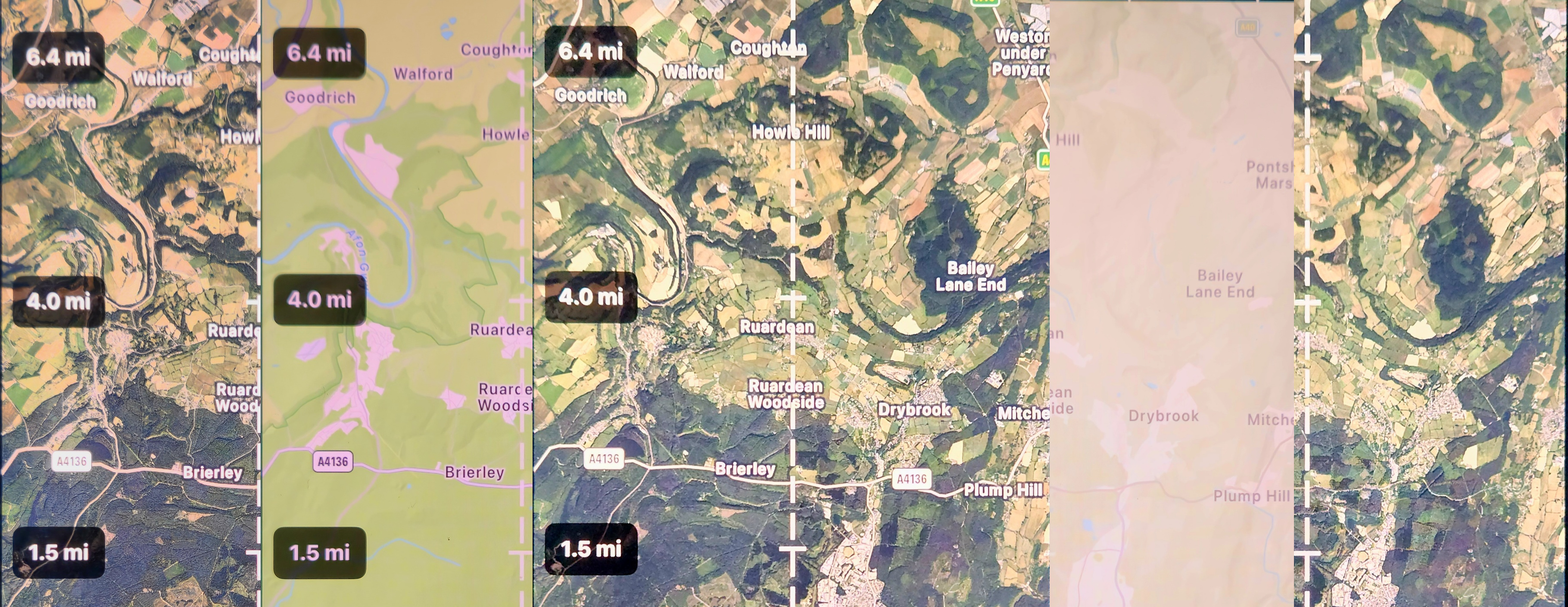
Switch seamlessly between satellite, street, terrain, and hybrid maps. Find the perfect view for any environment or navigation need.

Choose from five professionally optimized map styles to match your activity. Satellite view reveals trails and landmarks invisible on standard maps. Terrain mode shows elevation contours essential for hiking. Street view helps with urban exploration.

Our hybrid modes combine the best of both worlds - overlay street data on satellite imagery or blend terrain with roads. Switch instantly with a tap to compare views and gather maximum intelligence about your surroundings. Maps cache for offline use in remote areas.

7-Day
Free Trial
5
Map Styles
4.8★
App Store Rating
GPS
Precision Accuracy

Download Compass Explorer

Compass Explorer App Icon

Compass Explorer

★★★★★ 4.8 (50+ Reviews)

Precision GPS navigation with real-time satellite mapping. Perfect for hiking, exploring, and outdoor adventures. 7-day free trial, then $0.99/month or $9.99/year.

Download on the App Store